The site is made up of three locations: The mining town of Røros together its surrounding historical and cultural landscape, Vinterleden – the winter transport route and Femundshytta smelter.
Map showing the Circumference. The purple area is the area that was enlisted in 1980. The yellow areas show the extension of the World Heritage area in 2010.
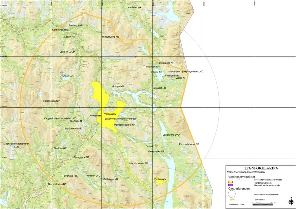
The Circumference is the resource area granted to Røros Copper Works (1644–1977) by royal ‘privilege’ in 1646. Within the Circumference, with a radius of 45 km and centred on Old Storwartz mine, the company was granted rights to utilise all resources. In this are examples of traditional houses and traces of the extensive operations of the Røros Copper Works – mining, smelting, transport, forestry and charcoal burning, waterways and dams.
Røros Copper Works contributed to the wealth of the country for more than 300 years. This was based on the extensive use of natural resources and labour, rapid technological development and strict organisation of the community and of the company’s own business.
The World Heritage Site Røros Mining Town and the Circumference is a unique witness to this time, and shows how both settlement and mining were adapted to a demanding climate and remote location. The history and culture of the population tell of barren conditions and frugal living. Agriculture was a major part of people’s livelihood, and trade with the Sami people in the area brought important resources from reindeer herding.